Lessons from Cyclone Amphan: Need to rethink development strategy
The question that arises uppermost is that are we learning the right lessons from these recurring weather episodes or just concentrating on immediate short-term disaster relief without taking any steps to make the regions ecologically sustainable and disaster resistant, writes Partha Pratim Mitra for South Asia Monitor
 May 25, 2020

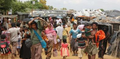
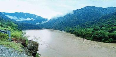
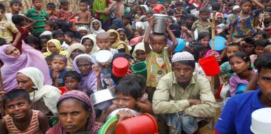
Cyclone Amphan, pronounced as Um-pun in Thai, means the sky. The cyclone has literally shown us the sky and what is in store for us, if we do not care for it while we get back to our routine with the business as usual approach. The mangrove forests of the Sundarbans form a powerful natural barrier that protects Kolkata Metropolitan Region’s roughly 14 million inhabitants and other human settlements from adverse natural events which otherwise would have hit the metropolis and its neighbourhood in a more disastrous way. Amphan has left 82 dead and about 40 percent of the trees uprooted in southern districts of West Bengal. It also left its mark in the coastal districts in the adjoining state of Odisha.
As a part of the Man and Biosphere Programme of UNESCO in 1970, the Government of India declared the entire area of Sunderbans consisting of 9670 sq km as the Sunderbans Biosphere Reserve (SBR) in 1989. The extent of mangrove forest in Sundarbans is about 4260 sq km, of which 55 percent is under land vegetation cover and balance 45 percent underwater body/intertidal zone. Nearly 40 percent of the forest area has been brought under protected area network, which consists of the Sundarbans National Park (1330 sq km), Sajnekhali Wildlife Sanctuary (362 km), Lothian Wildlife Sanctuary (38 sq km) and Haliday Wildlife Sanctuary (6 sq km)
‘Cyclone is the term used globally to cover tropical weather systems in which winds equal or exceed gale force (minimum of 34 knot, i.e., 62 km ph). These are intense low-pressure areas of the earth-atmosphere coupled with systems which are extreme weather events of the tropics. Although the North Indian Ocean (NIO) Basin (including the Indian coast) generates only about seven percent of the world’s cyclones, their impact is comparatively high and devastating, especially when they strike the coasts bordering the North Bay of Bengal. It is estimated that due to cyclones, nearly one-third of India’s total population is at risk. Climate change with the resultant sea-level rise is expected to increase severity of cyclones and can significantly increase the vulnerability of the coastal population.
There have been in the past such extreme weather events on the eastern coast of India. Odisha has seen the super cyclone of 1999, which had left about 20,000 dead. In 2004 there was a tsunami, in which about 10,136 people died in India with the majority of the casualties reported from Tamil Nadu. The extent of damage it caused was attributed to a number of reasons, mainly poor infrastructure, poor advance warning systems and large populations living in coastal areas.
In more recent times Cyclone Aila, which in May 2009 hit West Bengal in the same region that has been hit by Amphan, and had also affected some of its northern districts and parts of Bangladesh leaving about 300 dead in both the countries. On October 12, 2013, Odisha was hit by Cyclone Phailin, in which around 45 people were reported killed (44 in Odisha and 1 in Andhra Pradesh).
Only last year, we had two episodes - Cyclone Fani in May 2019, which devastated the temple town of Puri in Odisha and Cyclone Bulbul in November. Fani killed at least 89 people in eastern India and Bulbul's landfall in West Bengal around the Sunderban forest brought extremely heavy rain and 14 people died in storm-related incidents.
Between 2009 and 2013, the Indian Meteorological Department (IMD) improved its generation of early warning systems when it was only two days prior, compared to four days prior in the case of Phailin, which had helped evacuate large numbers of people and reduced casualties. The advanced warning systems have since improved further since then and Amphan was predicted about a week earlier by the IMD.
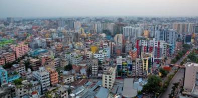
The devastating Cyclone Aila in 2009 was a wake-up call for the five million residents of the Sundarbans region. The cyclone had left about 150 people dead while over 40,000 homes were swept away. Aila had changed the landscape of the region. Three years after Aila, the influx of saline water rendered the soil unfit for agriculture forcing residents to migrate to places like Kolkata and Mumbai to work as daily wage labourers.
As we move from west to east of the Indian Sundarbans Delta (ISD), we see a marked change in the livelihood pattern\.TThe dependence on inland coastal fishery is predominant in the western parts of ISD. As we move eastwards in the ISD, the dependence is more on the forest products such as honey, forest and fishery. Livelihoods here come in direct conflict with the wildlife and here lies the additional challenge in the ISD to create sustainable livelihoods as the forest department imposes restrictions on the movement of the local residents inside the forest area.
Some of the development interventions, which the region saw through the plans of the state planning board was mostly in the form of extending irrigation systems, constructing and maintaining embankments, improving connectivity (e.g., roads, bridges, culverts), extending the provision of services such as drinking water and electricity, developing skills to improve the scope of non-agricultural employment, supporting pisciculture activities, improving education facilities, pursuing afforestation with community involvement ensuring community participation in local governance.
The West Bengal government also initiated a state disaster management policy and framework in 2005 that outlined a strategy for: (a) pre-disaster, (b) disaster phase, and (c) post-disaster response (Department of Disaster Management, 2005). This document outlines an implementation framework that includes the development of institutional mechanisms for implementation; a broad mitigation and prevention strategy that includes targets to develop a land-use planning framework; and disaster management planning down to the district and block levels including the ISD. However, the operationalisation of these plans were not adequate as seen during Cyclone Aila that devastated this region in May 2009.
While it is widely known that with global warming and the mean sea temperature levels rising, the Bay of Bengal like other oceans has become a source of constant worry to its coastal nations. About five million people living in coastal areas would be at risk if global temperatures were to rise by another 3.5 degrees Celsius, causing sea-levels to rise by an additional four feet by the end of this century and 16 feet by the year 2300, according to a recent study.
The question that arises uppermost is that are we learning the right lessons from these recurring weather episodes or just concentrating on immediate short-term disaster relief without taking any steps to make the regions ecologically sustainable and disaster resistant? Some critical measures that need to be taken to formulate a sustainable development strategy with popular local level participation should focus on skills, livelihoods, employability, housing and infrastructure.
There is a need to map demographic profiles of families engaged in fishery, poultry, piggery, sheep, goat rearing, fish and prawn farming along with the location of respective village, mandal and district, to be available with tehsildar and district administration. This data can be used in making their infrastructure disaster-resilient; informing them through early warning, and assessing the losses sustained by them. Capacity building of fisherman, prawn, cattle and animal rearing communities on mitigation and risk reduction measures to be taken for their animals/cattle is required and needs to be conducted on a regular basis. Policy may be introduced to ensure that all commercial poultry and other animal/cattle based industries are insured in cyclone prone areas.
A housing reconstruction policy also needs to be formulated in consultation with all stakeholders to ensure that each village shall be free from semi-permanent houses and huts made of mud in the vulnerable coastal areas. Construction of houses within the Coastal Regulation Zone (CRZ) region should be avoided as coast bank erosion takes place due to turbulent currents/tides during cyclones. There is also a need to maintain shelter belts and mangrove plantations in coastal areas.The National Policy on Disaster Management 2009 stipulates the tackling of disasters through disaster management cycle starting with prevention, early warning, preparedness, mitigation, response, relief and rehabilitation.
The Indian Sundarbans Delta-A Vision brought out by the WWF in 2011 gave a five-phase approach up to 2050, which called for SBR being formed a separate district with a special status and demarcated areas within Biosphere District by Green Line where development was not feasible and ecological restoration was essential. The Vision attempted to resolve the conflict between retaining a green zone within the Sundarbans through the Green Line and development of the region outside the Green Line, with focus on livelihoods, physical infrastructure, keeping in view the estimates of the rise in sea levels and its intensity, social infrastructure, financial inclusion skills and higher education.
This brings us to the core issue of making agriculture and livelihoods sustainable in the region. At present rampant use of chemical fertilisers and high yielding varieties of hybrid seeds, as opposed to local pest and saline- water-resistant seeds and traditional organic fertilisers, have affected the fertility of the land as in many other regions of the country. But what is different in these areas is the fact that they are ecologically sensitive, being close to the sea, take the direct hit of global warming with repeated weather episodes that devastate the local economies of the region, which have very little fall back options unlike the mainland regions of the country.
It is, therefore, absolutely necessary that organic agriculture be introduced in these areas which would take agriculture back to its natural vegetative sources bringing back sustainability of the sector. Although the yields could initially be lower than the method of intensive chemical-based agriculture, the practice would go towards making agriculture sustainable by making the soil less denuding and less prone to the vagaries of toxic chemicals.
The livelihoods that grow out of the agriculture and outside it could be based around food processing based on inputs made from organic farming and rural industries which are based on agro sources of raw materials that are organically grown, thereby making the entire system of the region ecologically viable and sustainable. In this direction there is a need for a rethink of the development strategy so that along with better cropping practices and agro-based livelihoods, skills and employability of the region also improves that prevents large-scale migration which is endemic to coastal regions.
(The writer is a retired Indian Economic Service officer who worked in the labour ministry. The views expressed are personal. He can be contacted at ppmitra56@gmail.com)


Post a Comment