

Ghost Communities of the Wakhan: How an Imperial Buffer Zone Became China’s Next Frontier
The Wakhan Corridor has become a possible trade road for China's economic expansion. The corridor provides China with strategic advantages. First, it offers potential overland access to Afghanistan and on to Pakistan and the Arabian Sea
 Aug 28, 2026
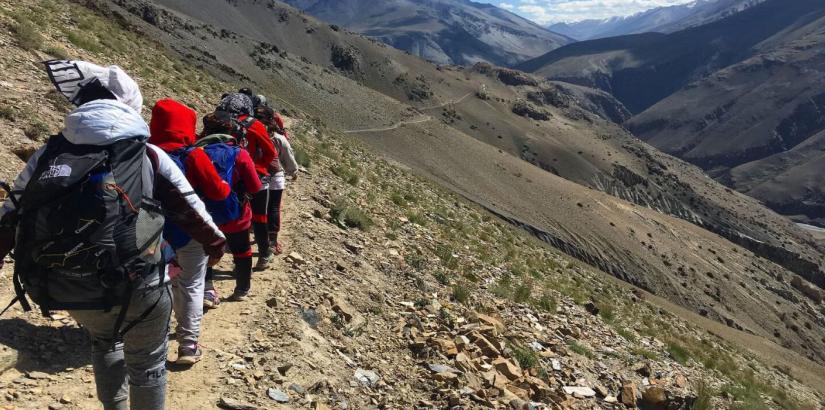
The geopolitical wilderness of the Wakhan Corridor is a mirror image of the 19th century imperial contest that gave rise to it. This thin corridor of Afghan land running between the Hindu Kush mountains and the border with China, that was drawn up just to stop the Russian and British nations from having contiguous territory, has become a geographical barrier that has kept the once-vibrant Silk Road communities away from regional trade and development.
This arbitrary imperial venture, wrought in the capitals of Europe and Russia with little attention to existing human communities, would end up affecting the lives of thousands and shutting off regions from regional trade routes for more than 100 years.
In contemporary times, the Wakhan Corridor is once again a hot-button issue, given the emergence of China's Belt and Road Initiative (BRI) and its influence on the course of global trade, not to mention the geopolitical dynamics between China and the West, as well as between Pakistan-Afghanistan and Sino-Afghanistan relations.
The Imperial invention
The Wakhan Corridor encompasses approximately 5,175 square kilometers of mountainous terrain, with the Panj River serving as the border with Tajikistan and the Durand Line (itself another imperial creation) separating it from Pakistan to the south. The corridor's width in some sections barely exceeds 15 kilometers, making it one of the world's most unusual border configurations.
This Wakhan Corridor is definitely neither an organic development nor a geographical or ethnic boundary but a careful planning by the politics and policies of the Imperials, drawn by men in London and St. Petersburg who had never personally traversed the route that was shown on the map, and that had been drawn to separate the communities and interrupt millennia of trade and commerce.
After the Russo-Afghan conflict ended in 1885, Russian and British representatives signed an agreement on delineation, thus establishing an impartial neutral zone between their spheres of influence. The negotiators, who were mainly focused on avoiding outright military conflict, seemed to have ignored the existing economic and cultural networks that already linked the region together. The corridor was not intended to acknowledge any right of territory ownership, nor was it to reflect any territorial integrity.
Severance of Silk Road Networks
The corridor area had been a part of the Central Asian trade system for centuries before it was formed. The Silk Road - that vast route for commerce, cultural and religious exchange - passed through these mountains, linking up the markets of China to those of Persia and the Arabs and the Indian traders to the Europeans. Complex trading networks existed outside of contemporary maps of borders between communities, notably in the Wakhi, Kyrgyz and Tajik communities. These groups had economic and cultural connections reaching far beyond their valleys and ran a dynamic economy through pastoral transhumance, local crafts and long-distance trade.
These old networks were systematically broken through by the construction of the corridor. The cultures and livelihood strategies of the Wakhan became anachronisms in the new imperial borders. Imperial policies effectively cut off the Wakhan from both Russian Central Asia and British India, creating what might be called 'ghost communities' whose histories and economies became outdated behind shifting borders. Seasonal migration routes of the Kyrgyz Pamiris were restricted by new international borders within the corridor, where they resided.
The pastoral economy they practiced was tied to the use of seasonal pastures in the now fragmented landscape and was not as sustainable. Likewise, the Wakhi people, whose agricultural settlements and trade networks had historically connected the region to broader Central Asian commerce, found their economic horizons dramatically compressed.
Contemporary Geopolitical Competition
For more than a century, the Wakhan Corridor was cast as a footnote in the international developments of Central Asia, remaining marginal to geopolitics. The current economic superpower, however, and the BRI have massively changed the strategic equation in the corridor. China is making big plans to build modern versions of the ancient Silk Road networks, linking the Chinese markets to Central Asia, the Middle East and the rest of the world, through a huge infrastructure investment programme it began in 2013.
The Wakhan Corridor has become a possible trade road for China's economic expansion. The corridor provides China with strategic advantages. First, it offers potential overland access to Afghanistan and on to Pakistan and the Arabian Sea, circumventing the Strait of Malacca and limiting China's reliance on sea routes that might be encircled by American naval forces.
Second, a transport belt running through the Wakhan would make China the chief economic power in the Central Asian region, thus strengthening Beijing's influence in the region.
Third, such development may tie the isolated communities along the corridor into China's economic processes, putting them in a dependency position to China's interests. China, therefore, has launched the first steps of diplomacy to look into the infrastructure possibilities in the Wakhan, not as isolated ‘ghost communities', but as the missing link in a new economic empire.
Where Past Influences Future
The Wakhan Corridor itself demonstrates that past events and influences, stemming from the era of empires that came before, are still influencing the future geopolitical landscape today. The cartographic solution that prevented Russian-British contact became a wall that sealed the vibrant communities of the Pamir Plateau and Hindu Kush valleys from the vibrant economic networks that were their neighbors.
Today, China's BRI poses a threat to reshape the economic potential of the corridor – but according to Beijing, not the people who live along the route. The future of this corridor is in the hands of distant powers that have to make strategic calculations.
In this particular respect, the Wakhan Corridor, still caught between empires and its human geography, is subject to the territorial instincts of empire makers. The knowledge of this history is crucial to understanding current Central Asian geopolitics and imperial cartography's long-lasting impact.
(The author is a fourth year political science student, a researcher specializing in international relations and diplomacy, endeavoring to bridge the gap between grassroots activism and public policy. The views expressed are personal. He can be reached at rishigurung1714@gmail.com
Instagram - https://www.instagram.com/gurung_rishi?igsh=MW03bm50aTR5MW5icQ==
LinkedIn - https://www.linkedin.com/in/rishi-gurung-34548b35b/ )







Post a Comment